
» » A Charles & Mieko Simon Web Site, ©2001 « «
Welcome to Our Web Site
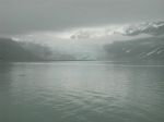
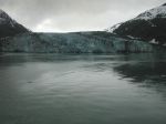
Glacier Bay National Park, Alaska
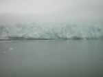
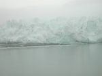
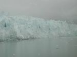
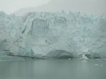
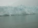
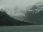
The weather was not cooperative at Glacier Bay. It was cold with low hanging clouds that covered the mountain tops. The water was extremely smooth but I think it is that way almost all the time. Somewhere I seem to have heard that it was best to view glaciers when it was cloudy as the colors were more easily seen. I do not know that I believe that. We were able to see the blue tint which is the only color reflected by ice.
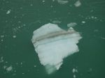
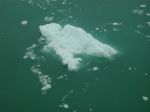
The interesting thing about Glacier Bay is that at one time the ice was 4,000 feet thick and 20 miles wide. That is a lot of ice. Secondly, between the years of 1750 and 1780, the glaciers extented all the way to the entrance to the bay. Explorer Captain Vancouver found Icy Strait, just outside of Glacier Bay, in 1794. It was full of ice. The ice at this time had receded about 5 miles into the bay. By 1860, it had receded an additional 25 miles. Twenty years later and 20 more miles into the bay. The latest that is shown on the National Park map is for 1976. When a glacier's advancing edge breaks off it is called “calving”. It does so with a thunderous noise and huge splash. There are 12 of these tidewater glaciers calving into Glacier Bay. All glaciers are in a constant state of movement, sliding down the slopes of the surrounding mountains. At water's edge they have no support so pieces are calving, some to become icebergs. The receding edges of the glaciers are still being monitored by the Park Service.
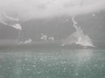

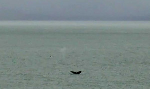
As we were leaving Glacier Bay, the Captain brought the ship to a stop and we watched for whales. We saw more than I was able to photograph. They are very elusive. It can not be predicted with a great deal of accurancy where they will surface so one just has to keep their eyes open and be quick with the camera.
To learn more of Glacier Bay see National Park Service site and Glacier Bay Human History.
For those who have fast DSL or cable connections, check out this site Multimedia History of Glacier Bay
All photographs copyright 2001, Charles R. Simon
